There are many countries in the world with long coastlines and rich water resources and rivers. They have built military ports, ports and nuclear power plants on the coastlines, carried out Marine pasture farming, coral reef farming, Marine wind power generation, etc., and built many different types of reservoirs and different Bridges on the rivers.
Some places are prohibited from ships, some places need to prevent collisions, so many areas need radar photoelectric integrated safety early warning monitoring.
This early warning system is applicable to Marine pasture poaching monitoring, lake no-capture monitoring, river monitoring, nuclear power safety monitoring, reservoir safety monitoring, bridge collision monitoring, offshore wind power collision monitoring, island unattended monitoring, ship assisted driving and so on.
The current problems in the waters:
1. Risks in waters
Ships drift, hit the reservoir, hit the entrance to the nuclear power plant, hit the bridge, hit the Marine wind power, illegal fish, ship trawling fishing, threatening the safety of the water and so on.
2. Low regulatory efficiency
The traditional mode adopts passive supervision such as naked eye and patrol ship, which has narrow monitoring coverage, lack of detection means, low supervision efficiency, time-consuming and laborious, and can not be supervised all day and all day.
3. Urgent need for improvement
Traditional supervision methods can no longer meet the requirements of real-time and efficient supervision, and it is urgent to use advanced scientific and technological means for detection and perception, build a comprehensive monitoring system in the waters, early warning of vessels sailing in the reservoir, establish effective emergency law enforcement plans, timely report emergencies, and take effective emergency measures, and build an all-day, all-weather water supervision system.
Ii. Project overview
In order to improve the safety monitoring and support capability of waters, to facilitate the unified monitoring and management of the monitoring center, to design professional services and complete solutions for the actual application environment and specific needs of on-site safety monitoring. Integrate the concept of security monitoring information, automation and intelligence into the security monitoring guarantee, and design the structure and function of the security monitoring system by studying the reception, processing and application of information.
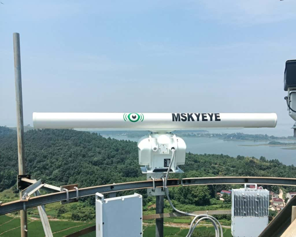
Deploy multiple intelligent perception system, and use radar, photoelectric equipment and AIS to carry out all-day, all-weather ship information perception and scene monitoring in the waters without blind areas.
Automatic Ship identification system (AIS) is configured to identify ship management, identify ships without AIS and not in the system library, and generate alarms. Notify law enforcement officers to remove the vessel.
Set up centralized control center, configure scenario analysis, threat warning system, and realize target information fusion, behavior analysis, intelligent discrimination, and disposal plan.
Third, the system composition structure
The water monitoring system is composed of centralized control center, monitoring base station and law enforcement unit, including multiple intelligent perception system, AIS information fusion, friend or foe identification system, threat warning system, radar signal and camera signal through wired or microwave wireless transmission to the centralized control center.
Multiple intelligent sensing system: Deployment of radar, photoelectric, AIS, GPS/ Beidou and other detection and sensing equipment.
Iff system: According to the AIS matching in the system library, IFF can be identified when the ship without AIS in the library or the ship without AIS installed.
Data fusion system: ARPA information captured by radar and AIS information fusion, and click on the relevant target, can be fused into the image data.
Auxiliary law enforcement system: Configure the corresponding sound and light alarm system to collect line data and video.
Scene analysis, threat early warning system: draw any polygon monitoring area, track and analyze incoming targets, and record ship trajectories.
Information transmission system: Each functional system adopts optical fiber or wireless device for information data transmission.
Time and space reference system: GPS, Beidou equipment, configuration of relevant system software, to achieve the time. Spatial information is consistent.
Four, the main functions of the system
Detection of ship targets in waters
Calculate the ship's position, course and speed.
Keep track of ships entering the area and record their trajectories
Dynamic and static information fusion with AIS.
Iff, generate alarm.
Radar-guided photoelectric tracking and identification of the ship
Photoelectric automatic capture of the ship and video forensics.
AI recognition is carried out on the manually selected ship to obtain its size. Moreover, AIS data and radar ARPA data are integrated.
Multi-level warning area setting, automatic alarm
Information recording, storage, playback.
Polygon alarm area Settings.
AIS information data fusion
Small target identification recording playback
Radar control Radar capture sets camera control