Application Area:
| Air Defense Surveillance |
This radar is applied to monitor general aviation manned aircraft and large unmanned aerial vehicles, prevent general aviation and terrorists from using drones to carry out attacks, and provide effective surveillance means for air defense departments in low-altitude airspace |
| Low Altitude Airspace Surveillance |
Radar can effectively monitor payload-capable drones that can pose a threat to key defensive targets, and can be used on defensive air surveillance in places such as island reefs, nuclear power plants, oil depots, prisons, airports, large conference venues, important government agencies, military units, border, etc. |
| Navigation Airport Proximity Monitoring |
The airspace coverage of this radar is consistent with the flight area of general aviation airport, and the radar does not need to be equipped with transponder, so it is suitable to be used as a small general aviation airport aircraft for proximity surveillance. |
| Wind Farm Anticollision Warning |
The radar performs three-dimensional surveillance of low-altitude airspace below 1000 meters. It can detect and track aircraft within the surveillance range. When the aircraft approaches a tall building, it sends a warning signal to the aircraft just like a night-time on-demand lighting system (BNK) for a wind farm. |
Main Features:
| Low altitude, Slow speed, High Capability Of Monitoring Small Target |
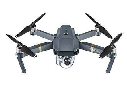
With advanced active phased array system and high updating rate of datas, it provides excellent low altitude, slow speed and small target monitoring capability. This product has excellent detection performance for low-altitude aircrafts. Its monitoring distance for Dajiang’s Mavic Pro model miniature four-rotor UAV is more than 5 km. And its monitoring range for 1RCS flying targets is more than 30 km. |
| Advanced System, Flexible Working Mode and Ability of Target Height |
MeasurementThe radar adopts the advanced receiving and transmitting digital beamforming system in the international market, which has the advantages of high utilization of radar resources and various modes of operation, flexible pointing and controllable beam direction, strong adaptability to the position, and can meet the needs of different tasks. The receiver adopts all-digital beamforming technology and has the capability of altitude measurement of non-cooperative targets. |
| High Integration, Low Cost, Miniaturization, High Reliability |
The radar equipment is integrated into the antenna or turntable except for the back-end processing and display equipment. It has the advantages of high integration, low cost, low loss, low infrastructure requirement on the installation site, convenient installation and high reliability, etc. |
Product Structure and Deployment:
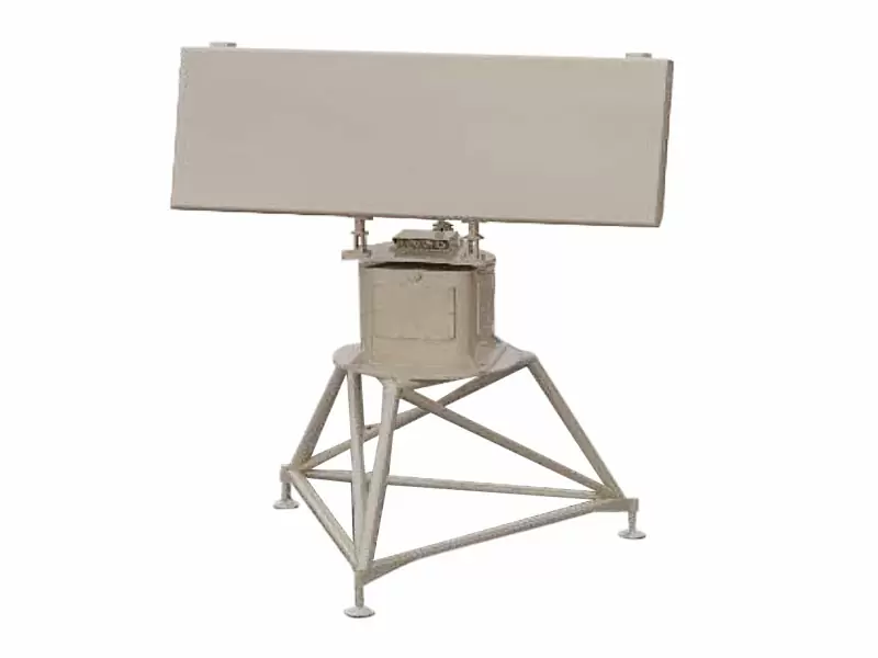
The antenna assembly of X-band civil low altitude 3-axis surveillance radar weighs about 50 kg and the turntable weight is about 30 kg. This product, with high deployment flexibility, can be installed on the top of the building or on vehicle platform (figure 1).
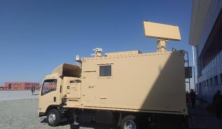
Figure1 Effect Diagram of Low Altitude Surveillance Radar Deployment |
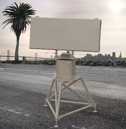
A Radar Fixing Diagram |
 |
 |
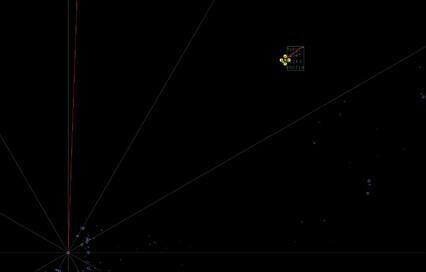
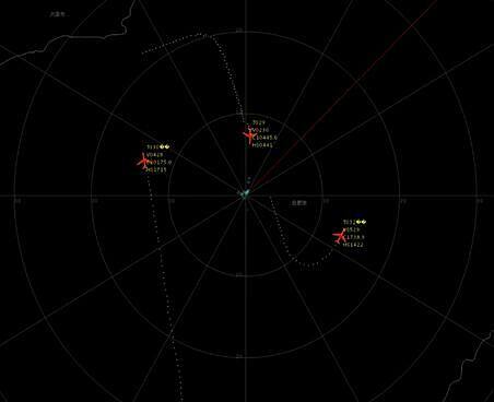
| Figure 2 Monitoring Diagram Of General Aviation Planes |
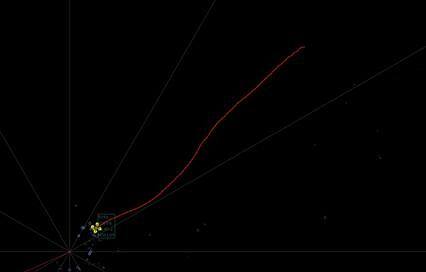
Figure 3 UAV (Dajing Mavic Pro) |
Figure 4 UAV (Dajing Mavic Pro) Monitoring DiagramX-band civil low altitude 3D surveillance radar also satisfies the surveillance of UAV, and its monitoring range depends on the size of UAV. Taking the UAV produced by Dajiang Company, which has 70% market share of global commercial UAV, as the experimental object, the monitoring distance of the larger Mavic Pro miniature four-rotor UAV is more than 5km, and the screenshot of the surveillance picture is shown in Figure4.
Technical Specification
| Maximum Detectable Range |
Minimum Detectable Range |
Height Coverage |
Azimuth Coverage |
| 0Measurement Certainty |
≤50m(R.M.S) |
0°~360° |
| ≤0.4°(R.M.S) |
|
|
| ≤0.5°(R.M.S) |
|
|
| 200 batch / framSignal Processing Mode |
Digital pulse compression、MTD、CFAR、Clutter map |
| 12 turn/minuteReliability and Maintainability |
≥8000h |
|
| ≤30m |
|
|
|
| ≥95% |
|
|
|
| Working Temperature |
℃~+50℃(outdoor equipment) |
|
|
| ℃~+40℃(indoor equipment) |
|
|
| -50Relative Humidity |
(outdoor equipment,35℃) |
|
| (indoor equipment,30℃) |
|
|
| ≤3000m |
|
|
| Working wind speed 25m/s |
|
|
| Source |
~220V±10%,50Hz±5% |
| ≤600W |
|
|
| Time Service Mode |
Timing Precision |
Positioning accuracy |
10m |
| Antenna Size |
1740mm×655mm×152mm |
| Machine Weight(include swivel table) |
80kg |