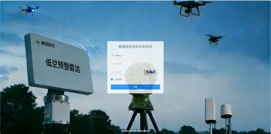
随着低空经济的快速发展,低空、低速、小型无人机的非法飞行风险持续增加,突显了机场禁飞区和军事基地等关键区域低空安全的日益压力。安徽利旺的低空目标识别系统,以其权威感知、智能识别、精准应对和全面控制的核心功能,构建了集成的低空安全保护系统,为关键区域建立了坚实的低空安全屏障。
- 综合感知与监控:对低空情况的无障碍控制
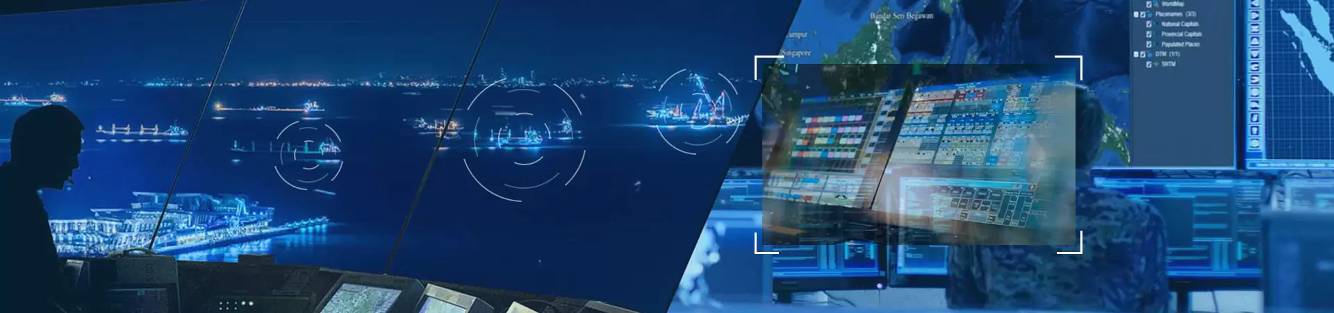
该系统的实时情况模块就像一个“长距离眼睛”,能够在整个区域进行无盲点的检测,相关数据在大屏幕上集中显示。
该模块专注于日常监控和异常分析。左侧清楚地显示了设备的数量和实时警告的类型,而右侧有一个视频窗口。它还使用折线图和饼图直观地呈现警告数量的趋势,使维修人员能够掌握低空安全的动态。
操作方便灵活。左侧侧栏中的工具箱支持切换地图类型、调整场景模式和设置自定义标签等功能。可以通过滚动鼠标来放大和缩小地图。它还内置了常见的地图测量工具,如距离测量和面积测量,以满足各种场景需求。
视频窗口可以通过拖动左下角自由调整大小。下面的警告信息窗口实时更新,同步显示雷达和光电设备信息。定位功能允许用户直接在地图上查看设备的安装位置,实现设备状态的可视化管理。

- 智能识别与跟踪:准确区分目标,不偏移
该系统拥有强大的智能识别和跟踪能力。切换地图到高德地图后,右键点击光电传感器图标,选择可见光即可查看实时光电传感器视频。光电传感器的覆盖区域用阴影圆圈标记,并用长线指示观察方向,确保精确定位。
Clicking on a target detected by the radar will instantly display key information such as target type, speed, altitude, latitude and longitude. After selecting the AI recognition function, the camera will automatically track the drone target, with clear video footage and smooth tracking.
In terms of performance, the system is outstanding. For small rotary-wing drones with an RCS as low as 0.01 square meters (such as the DJI AI22S), the radar's maximum detection range reached 9 kilometers in the Chaohu experiment; the AI algorithm combined with spectrum equipment can identify more than 300 drone models, and through feature extraction and intelligent comparison, it can effectively distinguish drones from interference clutter such as birds and fallen leaves, avoiding misjudgment.
In various tests, the system performed stably and reliably: In the test at Taihu Lake in Suzhou, the radar started detection at 6 kilometers and fused the RID data at 4 kilometers. The radar-guided photoelectric system started stable tracking from a blurry state at about 4 kilometers .
In comparative tests in Suzhou's urban area, when faced with drones on blacklists and whitelists, as well as unknown models of racing drones, radar detected drones at a range of 4 kilometers, guided photoelectric tracking at a range of about 3 kilometers, and fused RID data at a range of 900 meters. This allowed for accurate differentiation between drones on blacklists and whitelists, providing precise data for subsequent handling.
III. Flexible Early Warning and Response: Rapid and Efficient Multi-Dimensional Response
The system supports user-defined warning and countermeasure zones, allowing for flexible setting of protection ranges based on the security needs of different areas. The system automatically matches the optimal response strategy, achieving personalized security management. When a violation is detected, the system promptly delivers warning information to maintenance personnel through various methods such as audible and visual alerts, pop-up warnings, and SMS notifications, ensuring rapid response and saving valuable time for handling the situation.
The precise coordination between radar and electro-optical systems is a major advantage of the system. Their collaborative work enhances the effectiveness of low-altitude air defense, leaving no place for illegal drones to hide and laying a solid foundation for the implementation of subsequent countermeasures.
- Diverse and Precise Countermeasures: Safely and Efficiently Intercepting Illegal Targets
In terms of countermeasures, the system offers diverse solutions, balancing efficiency and security. On one hand, it can integrate countermeasure equipment, working collaboratively with multiple devices such as radar, photoelectric, and spectrum sensors to link with a spectrum countermeasure system, enabling timely interception of illegal targets and rapid elimination of security risks;
On the other hand, a safer countermeasure method has been innovatively introduced. By installing a capture net launcher on the drone, the system can accurately guide the target drone to lock on and capture it, avoiding the secondary risks that may be brought about by traditional countermeasures.
With the rapid development of the low-altitude economy, the risks of illegal flights by low-altitude, slow-moving, and small drones continue to rise, highlighting the increasing pressure on low-altitude security in key areas such as airport no-fly zones and military bases. Anhui Liaowang's low-altitude target identification system, with its core features of authoritative perception, intelligent identification, precise countermeasures, and comprehensive control, constructs an integrated low-altitude security protection system, building a solid low-altitude security barrier for key areas.
- Comprehensive Perception and Monitoring: Unobstructed Control of Low-Altitude Situation
The system's real-time situation module is like a "long-range eye," enabling detection across the entire area without blind spots, and relevant data is centrally displayed on a large screen.
The module focuses on daily monitoring and anomaly analysis. The left side clearly displays the number of devices and the types of real-time warnings, while the right side has a video window. It also uses line graphs and pie charts to intuitively present the trend of the number of warnings, allowing maintenance personnel to keep abreast of the dynamics of low-altitude safety.
The operation is convenient and flexible. The toolbox on the left sidebar supports functions such as switching map types, adjusting scene modes, and setting custom labels. The map can be zoomed in and out by scrolling the mouse. It also has built-in common map surveying tools such as distance measurement and area measurement to meet diverse scenario needs.
The video window can be freely resized by dragging the lower left corner. The warning information window below updates in real time, synchronously displaying radar and optoelectronic equipment information. The positioning function allows users to directly view the equipment installation location on the map, enabling visualized management of equipment status.
- Intelligent Recognition and Tracking: Accurately Distinguishes Targets Without Deviation
The system boasts powerful intelligent recognition and tracking capabilities. After switching the map to Amap, right- click the photoelectric sensor icon and select visible light to view real-time photoelectric sensor video. The photoelectric sensor coverage area is marked with a circular shaded area, and the observation direction is indicated by a long line, ensuring precise positioning.
Clicking on a target detected by the radar will instantly display key information such as target type, speed, altitude, latitude and longitude. After selecting the AI recognition function, the camera will automatically track the drone target, with clear video footage and smooth tracking.
In terms of performance, the system is outstanding. For small rotary-wing drones with an RCS as low as 0.01 square meters (such as the DJI AI22S), the radar's maximum detection range reached 9 kilometers in the Chaohu experiment; the AI algorithm combined with spectrum equipment can identify more than 300 drone models, and through feature extraction and intelligent comparison, it can effectively distinguish drones from interference clutter such as birds and fallen leaves, avoiding misjudgment.
In various tests, the system performed stably and reliably: In the test at Taihu Lake in Suzhou, the radar started detection at 6 kilometers and fused the RID data at 4 kilometers. The radar-guided photoelectric system started stable tracking from a blurry state at about 4 kilometers .
In comparative tests in Suzhou's urban area, when faced with drones on blacklists and whitelists, as well as unknown models of racing drones, radar detected drones at a range of 4 kilometers, guided photoelectric tracking at a range of about 3 kilometers, and fused RID data at a range of 900 meters. This allowed for accurate differentiation between drones on blacklists and whitelists, providing precise data for subsequent handling.
III. Flexible Early Warning and Response: Rapid and Efficient Multi-Dimensional Response
The system supports user-defined warning and countermeasure zones, allowing for flexible setting of protection ranges based on the security needs of different areas. The system automatically matches the optimal response strategy, achieving personalized security management. When a violation is detected, the system promptly delivers warning information to maintenance personnel through various methods such as audible and visual alerts, pop-up warnings, and SMS notifications, ensuring rapid response and saving valuable time for handling the situation.
The precise coordination between radar and electro-optical systems is a major advantage of the system. Their collaborative work enhances the effectiveness of low-altitude air defense, leaving no place for illegal drones to hide and laying a solid foundation for the implementation of subsequent countermeasures.
- Diverse and Precise Countermeasures: Safely and Efficiently Intercepting Illegal Targets

In terms of countermeasures, the system offers diverse solutions, balancing efficiency and security. On one hand, it can integrate countermeasure equipment, working collaboratively with multiple devices such as radar, photoelectric, and spectrum sensors to link with a spectrum countermeasure system, enabling timely interception of illegal targets and rapid elimination of security risks;
另一方面,引入了一种更安全的应对方法。通过在无人机上安装捕获网发射器,系统可以准确引导目标无人机锁定并捕获它,避免传统应对措施可能带来的二次风险。
安徽妙王科技有限公司为客户提供定制解决方案,利用先进的设备性能、丰富的项目经验和全面的支持系统。未来,我公司将继续专注于低空安全技术的创新,保障低空经济的健康发展,并为更安全、更有序的低空环境做出贡献。
Mskyeye为客户提供定制解决方案,利用卓越的设备性能、丰富的项目经验和全面的支持系统。未来,我公司将继续专注于低空安全技术的创新,保障低空经济的健康发展,并为更安全、更有序的低空环境做出贡献。